Let’s sing you a romantic poem, for happy people who love to roam! (very roughly) G.Lenorman
ON FOOT, BY BIKE, OR ON HORSE-BACK

So today we’re tackling a 29km route through the Pays Bourgueillois, in the heart of the glorious Parc Naturel Régional Loire Anjou Touraine. Kit packed in a rucksack, trainers on and we’re off folks!
The Loire landscapes prove unforgettable.
Even hardened hikers can’t help but slow down to enjoy such panoramas, looking over vineyards as far as the eye can see!
Along the way we encounter horse-riders enjoying an outing through the woods. Beside a stream, a family has found the ideal spot for a picnic in a green setting.
As the end of the day approaches, we’ve covered a good number of kilometres, reaching the picturesque village of Bourgueil, which we can’t resist visiting. Of course, that also means touring a wine cellar to learn about and taste the fine local wine. After all, we deserve a treat!
Despite feeling tired, we won’t be able to resist trying out further local trails, but tomorrow we may well head out by bike this time, to explore Langeais and the wild side of the Loire…
A NETWORK OF TRAILS FOR ALL KINDS OF USERS
Our network of 700km of trails is set out in a special map-cum-guide suitable for hikers, horse-riders and mountain-bikers, allowing all to decide on the circuit they wish to tackle, according to their level.
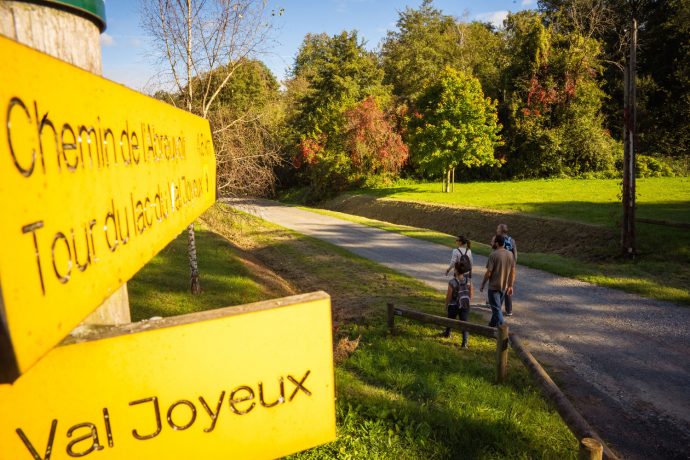
You only need to follow one colour of signpost – yellow. At every intersection, the relevant signpost allows you to locate where you are on your trail and gives you the distance to the next crossroads, or to the next village.
THE CARTO-GUIDE, A MAP-CUM-GUIDE TO PLAN YOUR TRAIL
This map-cum-guide indicates our whole network of trails. You can purchase it from our tourist offices for the price of €4.
Distances, intersections, viewing points and remarkable sights are indicated, as well as changes in altitude. So it’s easy to select the sections that suit you, both in terms of length and difficulty, going from a gentle family stroll to a more challenging or sporty outing with friends.
To download the GPX file of signposted trails in the Touraine Nature area, go to the website www.visugpx.com